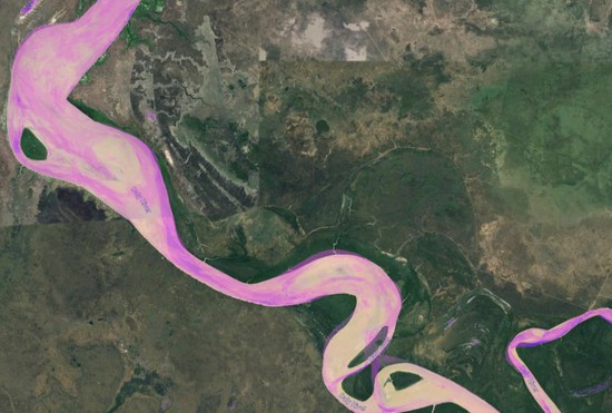
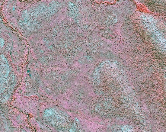
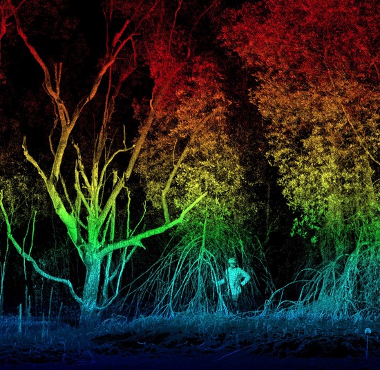
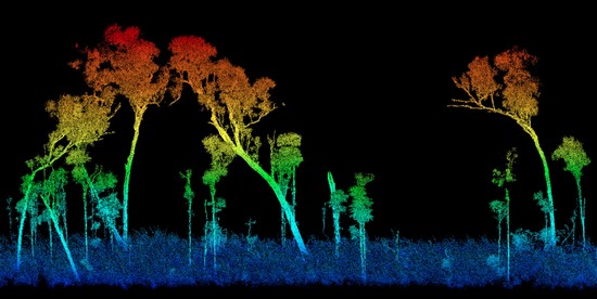
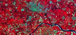
Skills

Research and consulting expertise

Remote Sensing

Earth Observation

GIS

Spatial insights

Ecology

Landscape management

Projects

Daly River floodplain dynamics

NESP funded project exploring floodplain inundation patterns in the Daly River catchment

Remote sensing of gamba grass invasion

NESP funded project exploring remote sensing options for invasive weed monitoring.

Biodiversity analytics from space

Remote sensing of biodiversity to inform natural capital accounting

Mangrove rehabilitation monitoring

Remote sensing of mangrove health and dynamics

Reducing uncertainty in carbon accounting

Bringing rigour to carbon markets through remote sensing

Experience


Principal Research Scientist

CSIRO Land and Water

Mar 2020 – Present Darwin, Australia
Responsibilities include:

  • Earth observation ecology
  • Project leadership
  • Spatial data analytics
  • Geospatial consulting


Associate Professor

Charles Darwin University & CSIRO Land and Water

May 2017 – Present Darwin, Australia
Responsibilities include:

  • Ecological remote sensing research
  • Spatial data analytics teaching
  • Supervision of PhD students
  • Geospatial consulting


Group Leader - Landscape Processes

Max Planck Institute for Biogeochemistry

Jan 2012 – Apr 2017 Jena, Germany

Recent Publications

Quickly discover relevant content by filtering publications.

Widespread degradation of tropical forests is caused by a variety of disturbances that interact in ways that are not well understood. …

Obtaining reliable measures of tree canopy height across large areas is a central element of forest inventory and carbon accounting. …

The reliability of airborne light detection and ranging (LiDAR) for delineating individual trees and estimating aboveground biomass …

Recent & Upcoming Talks

Teaching activities

This short course brings together the theoretical concepts of landscape ecology with spatial analysis techniques from remote sensing …

The aim of this course is to provide an introduction to the theory and practice of using remotely sensed data for environmental …

Popular Topics

Acacia Active Fault Alien plant ALOS PALSAR Amazonia Ammonia-oxidizing archaea Ammonia-oxidizing bacteria AmoA Animal movement Backscatter Basal area increment Basaltic bedrock Bioassay biodiversity Biodiversity conservation Biomass biomass loss Black rhino Boreal forest Boundary Broad-leafed Camera traps Canopy height Canterbury earthquake sequence carbon carbon and water fluxes Carbon density map Carbon monitoring Carnegie airborne observatory Catena change detection climate change Climate Solutions cloud-computing co-benefits coastal protection Cold water extracts Coleoptera Community Competition index Conceptual State-And-Transition Models conservation Context-dependency Darfield earthquake Data acquisition Decomposition Delineation disturbance Diversity-productivity Drought drought-induced mortality Dynamics earth observation ecognition Ecological sustainability Ecosystem heterogeneity Elephant Elephant herbivory Elephant trap Emissions Reduction Fund Environmental filter Exclosure experiments Experiment Fault avoidance zone Fire Fire frequency Fire management fire scar floodplain Foraging Forest Forest biomass Forest carbon stocks forest degradation forest dieback forest dynamics Forest Management forested climatic zones Gamba grass GEE Geohazards Global carbon cycle Google Earth Engine Granitic bedrock Grasshoppers Growing stock volume Habitat use Herbivory heterogeneity Host specificity hyperspectral Image processing Imaging spectroscopy Insect herbivory invasion Inventory Kruger Kruger National Park L-band Land use Land use planning Landscape landscape ecology LiDAR Low-cost UAS Macrotermes Management Mega-herbivore Micro habitats monitoring Neighbourhood diversity NESP Non-stationarity Nutrient contents Nutrients Park management Pattern-process Pests And Pathogens Plant biomass plant functional traits plant–climate interactions productivity Protected areas recovery rehabilitation Reintroduction remote sensing research gaps resilience SAR remote sensing Satellite savanna Savanna ecology Savanna Methodology Savanna soils Savanna structure scale Seasonality Segmentation Single tree detection South Africa Spatial Spatial heterogeneity Species richness Stereo Strike-slip fault structure Structure frommotion Support vector machine Surface fault rupture map Temperate Temperate forest Termite terrestrial laser scanning Thresholds of potential concern time-series analysis Topography Tree Die-Off tree mortality Tree turnover Treefall Treefall dynamics Tropics Vegetation Vegetation structure water water deficit Weed mapping windstorms Wood volume Woody cover

Contact