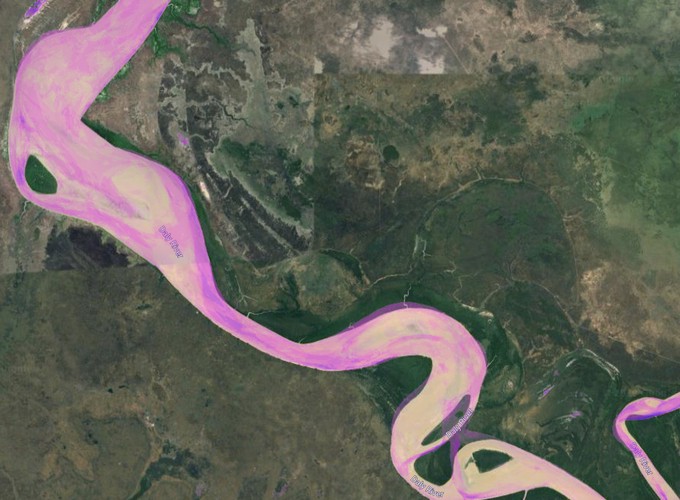
The main aim of this NESP funded project is to explore floodplain inundation patterns and improve understanding of ecological flow requirements in the Daly River catchment. Time-series of Landsat-5/7/8 and Sentinel-1⁄2 satellite images are being integrated to track inundation patterns through time and space.
Time-series of water inundation from Sentinel-2 imagery
Daly River floodplain dynamics
 Time-series of water inundation from Sentinel-2 imagery
Daly River floodplain dynamics
Shaun R Levick
Principal Research Scientist
I am a geospatial ecologist who uses remote sensing and spatial data analytics to improve land management outcomes in tropical ecosystems. My research focusses on natural capital accounting, biodiversity analytics, landscape rehabilitation, and computer vision for science communication.